

Creag Ghlas Laggan [Fionn Bhealach]
Good walks are even better shared.
Overview
Creag Ghlas Laggan [Fionn Bhealach]
Creag Ghlas Laggan is a delightful Marilyn nestled in the heart of the Scottish Highlands, reaching an elevation of 709 meters. This mountain may not have the altitude of its taller neighbours, but its charm and stunning vistas make it a worthy contender for any hiker's to-do list.
Geology
The rocky compositions of schists and gneisses paint a geological narrative telling of the earth's tumultuous past. Ideal for rock lovers, this solid geological foundation is as sturdy as a Highlander's resolve, providing a secure footing for adventurous souls.
Routes
Fionn Bhealach Approach
Starting just off the A82 near Invergarry, this moderate 8.5 km route takes approximately 3.5 hours to ascend. As you wind your way through the glen, don’t forget to take in the sights—each twist and turn reveals another phenomenal view.
Summit Features
The summit boasts a modest stone cairn, perfect for bragging rights with your hiking buddies. If you're lucky, a whimsical crow may even join your summit celebration!
Terrain
Expect a delightful mix of grassy slopes and rocky outcrops. While it’s mostly casual, there’s enough ruggedness to keep the adventurous spirit alive. Pack sturdy boots and a sense of humour, as the terrain can challenge even the wittiest!
Views
Highlights
Upon reaching the summit, the breathtaking sight of Loch Ness sprawls out beneath you, with the Great Glen and Cairngorms teasing in the distance. Perfect for a panoramic photo op or, dare I say, an artistic muse!
Best Seasons
The best seasons to visit are spring and autumn. Spring can treat you to colourful wildflowers, while autumn drapes the landscape in glorious golden hues. Just be ready for some cool breezes that can sneak up on you!
Hazards
As enchanting as this Highland gem is, be mindful of the potential hazards: sudden weather changes can turn a sunny jaunt into a wet Scottish surprise, and loose rocks can keep you on your toes—literally. Always check the forecast before setting off, and if your gut says it’s time to head back, don’t argue with it!
Nearby Summits
If you're feeling particularly ambitious, why not also conquer Sgurr a' Mhaoraich, its formidable neighbour rising to a height of 953 meters? The more, the merrier!
Access
- Nearest Parking: A small parking area on the A82 can accommodate several vehicles, but it fills up fast on sunny weekends—so don’t dawdle!
- Public Transport: Local buses from Inverness will get you to Invergarry, but maybe pack your good luck charm, as schedules can be a bit hit or miss.
- Nearest Town: Invergarry is your best bet for all essentials—grab a pastry or two, you’ll need the energy!
Facilities
The village offers a few local cafes and shops, but don’t bank on finding a five-star restaurant around here. Think more along the lines of hearty, homemade goodness.
History
Name Meaning
Creag Ghlas Laggan, meaning 'Grey Crag of the Hollow', is a nod to its distinctive feature. It’s the kind of name that tells a story, ain't it?
Significance
Historically, this area is rich in tales of clan conflicts and reverence. Perfect for those who love a bit of storytelling with their trekking!
Gear up and enjoy your adventure on Creag Ghlas Laggan! The mountains are calling, and you must go!
Explore routes near Creag Ghlas Laggan [Fionn Bhealach]
Public walks starting within 80 km of this hill. Nearby does not mean a route reaches the summit; check its map and access before setting out.
Goatfell from Cladach
View route
Bishop’s Glen group walk
View route
West Bay walk and talk
View route
West Bay walk and talk
View route
Route planning notes
These notes describe possible approaches, not verified navigable routes or permission to cross land. Check current paths, local access rules and conditions before setting out.
Fionn Bhealach Approach
This route starts from the A82 near Invergarry, leading up through a scenic glen, offering stunning views of the encircling mountains.
Make a day of it, together
Find someone to share the walk with, or organise a day out along a route you like.
Photo Gallery
View all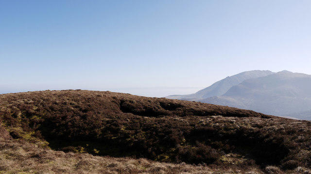 Photo could not load
NR9749 : Hollows at summit area of Creag Ghlas Laggan
Trevor Littlewood
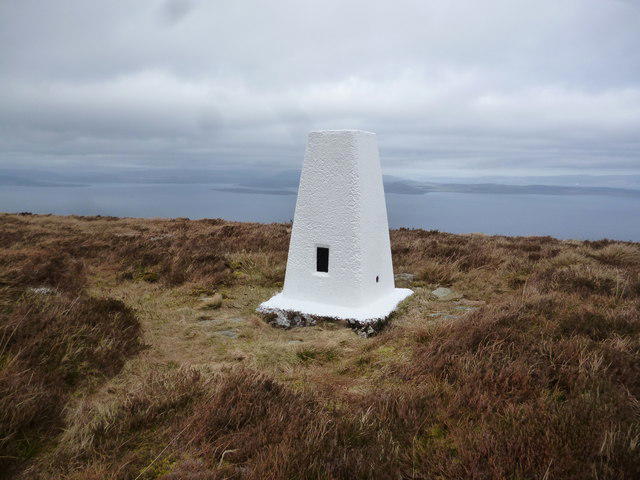 Photo could not load
NR9749 : Laggan Trigpoint
Brian Robertson
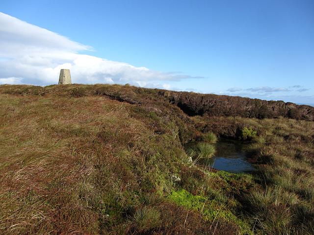 Photo could not load
NR9749 : Creag Ghlas Laggan summit
Richard Webb
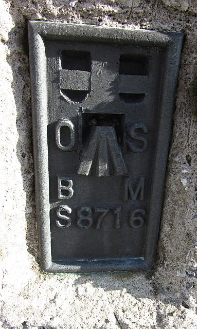 Photo could not load
NR9749 : Creag Ghlas Laggan flush bracket
Richard Webb
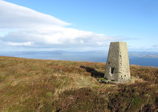 Photo could not load
NR9749 : Creag Ghlas Laggan summit
Richard Webb
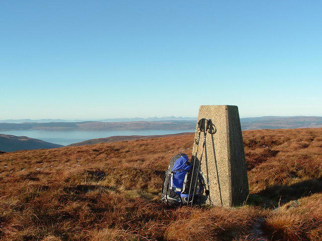 Photo could not load
NR9749 : Fionn Bhealach
Raibeart MacAoidh
Hill facts and local notes
Classifications
Elevation
444m
1,457 ft
Prominence
241m
Coordinates
55.6988, -5.2205
NR977497
OS Map
62 69
Explorer: 361N
At the Summit
The summit sports a small stone cairn, providing a perfect backdrop for a 'triumphant on-top-of-the-world' selfie!
Terrain & Geology
Creag Ghlas Laggan is predominantly formed from schists and gneisses, typical of the Old Red Sandstone found in the Highlands, providing a solid base for the adventurous climber.
Views & Scenery
From the summit, you can see the majestic Loch Ness and the sprawling Great Glen, with a hint of the distant Cairngorms on a clear day.
History & Heritage
Name Origin
Creag Ghlas Laggan translates to 'Grey Crag of the Hollow', likely referring to its distinctive shape and the surrounding features.
Historical Significance
Known as a spot for ancestor worship among local clans, it adds a rich layer of historical depth to your hike.
Getting There & Facilities
Check current local access restrictions, parking rules and transport timetables before travelling. These notes do not confirm public access to the summit.
Parking
There is a small parking area off the A82, just south of Invergarry, suitable for several cars.
Public Transport
Local buses run from Inverness, but check the schedule as service can be sparse; hitchhiking is also an option if you're feeling lucky!
Nearby Facilities
The nearby village of Invergarry has a small shop and a few local cafes for refreshments, but facilities are limited.
Safety Information
Known Hazards
- Be wary of sudden weather changes in the Highlands; conditions can flip faster than a pancake!
- Watch for loose rocks, especially on the descent.
General Safety Tips
- Check weather conditions before setting out
- Carry appropriate clothing and equipment
- Let someone know your planned route
- Take a map, compass, and GPS device
- Carry emergency supplies: food, water, first aid kit, torch
Hills
Some common questions about the hills answered
Are there group walks up Creag Ghlas Laggan [Fionn Bhealach]?
Many walkers use Walkmates to join or organise walks with others. You can check for group walks around Creag Ghlas Laggan [Fionn Bhealach] through the maps
Are there other walkers around Creag Ghlas Laggan [Fionn Bhealach]?
Activity varies by location and time, but Walkmates lets you see whether others have shared walks or shown interest in this area. Find other people through the walking friends search walking friends for Creag Ghlas Laggan [Fionn Bhealach] search or of course create your own walk for Creag Ghlas Laggan [Fionn Bhealach]
Can I organise a walk to Creag Ghlas Laggan [Fionn Bhealach]?
Yes. If there aren’t any walks listed already, you can create a walk and make it available for others to join.
If you're signed up to Walkmates, you can create a walk to Creag Ghlas Laggan [Fionn Bhealach].
How do I find a walk up this hill?
There are often multiple ways to walk this hill, depending on experience and route preference. Walkmates helps you explore walks and routes that others have shared.
Can I suggest a new route up Creag Ghlas Laggan [Fionn Bhealach]?
Yes. You can suggest or create routes to share with others. Walkmates focuses on the social side of walking, so routes are used to help people organise walks and explore areas together, rather than as detailed navigation tools or route libraries.
Other uses really appreciate knowledgeable walkers sharing their routes. Share your favourite route to Creag Ghlas Laggan [Fionn Bhealach] here
The is an error or something incorrect about this hill. How do I let you know?
We always strive to keep the information on Walkmates as accurate as possible. If you find an error, please let us know through the contact form and we'll aim to correct it as quickly as possible
Community Discussion
Comments
Location
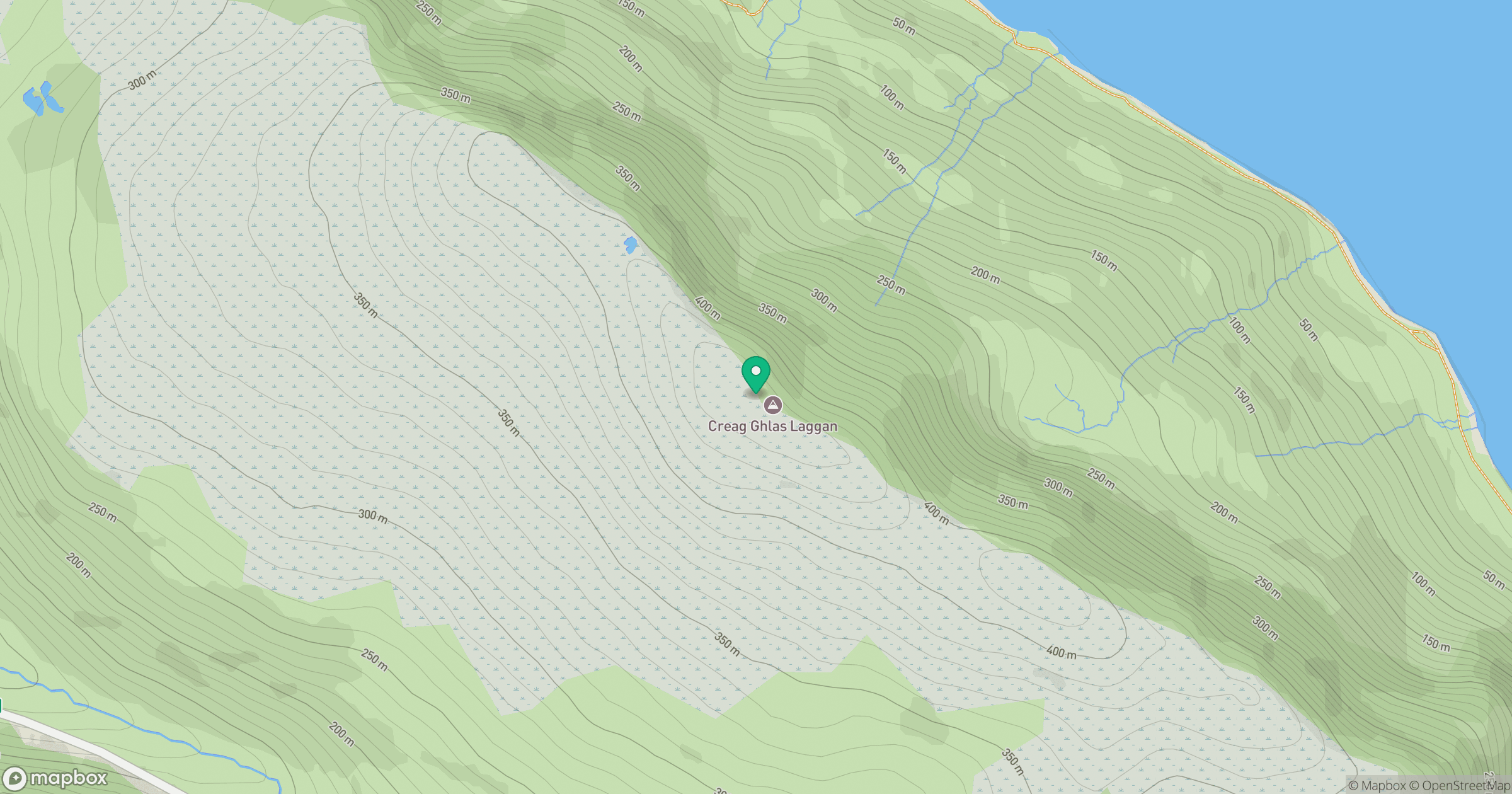
Grid reference: NR977497
View on OpenStreetMapOpens a map in a new tab, centred on the hill.
Hills within 30 km
Straight-line distance, not a walking route or confirmation of access.
No comments yet. Be the first.